
 Effingham, IL-(Effingham Radio)- We have a chance for some light snowfall the next couple days, but Wednesday brings a higher chance for precipitation, likely to be sleet and freezing rain.
Our first round of snow arrives tonight.
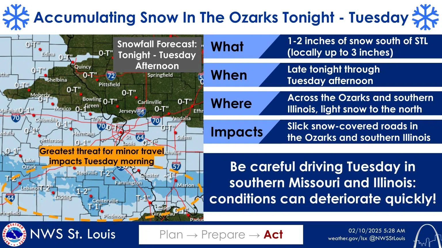
A band of snow is forecast across the Ozarks and southern Illinois tonight through Tuesday afternoon. 1-2″ is forecast in the band, with a few spots approaching 3″ locally. North of the band, little to no snow is forecast. Those in southern IL tomorrow should be careful when driving!
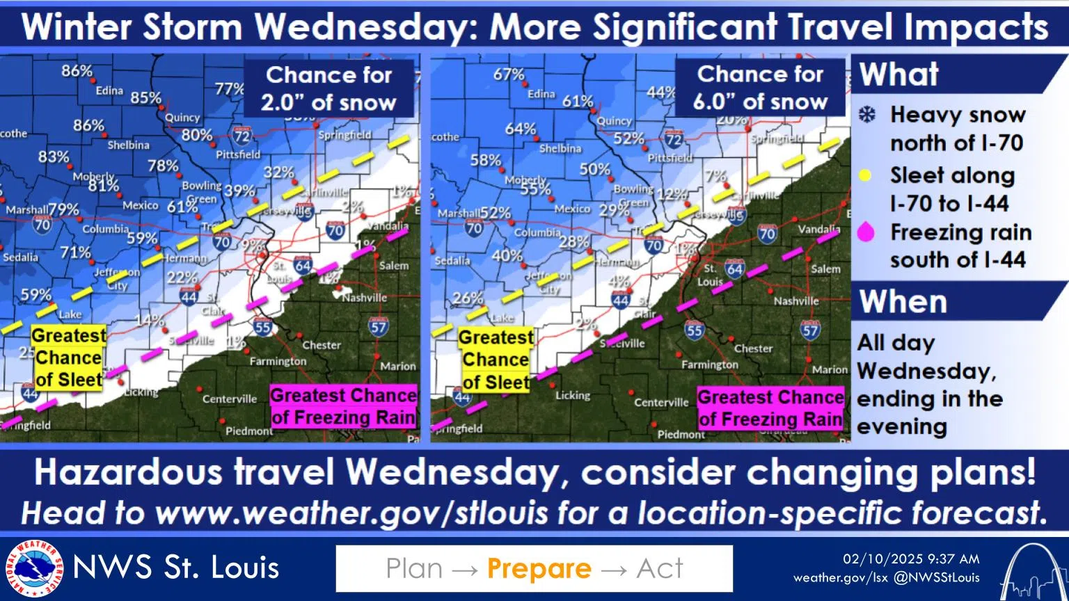
A stronger winter storm will arrive Wednesday. Expect heavy snow, sleet, and freezing rain, though where the transition between precipitation types will be is still uncertain. Mixed precipitation is likely to be favored south of a Shelbyville to Danville line.
Regardless, travel will be hazardous region-wide on Wednesday.
Photos and Story Courtesy of NOAA


Comments