
 Effingham, IL-(Effingham Radio)- Severe weather is back in the forecast, and so is a potential for some snow, however it is unlikely to stick.
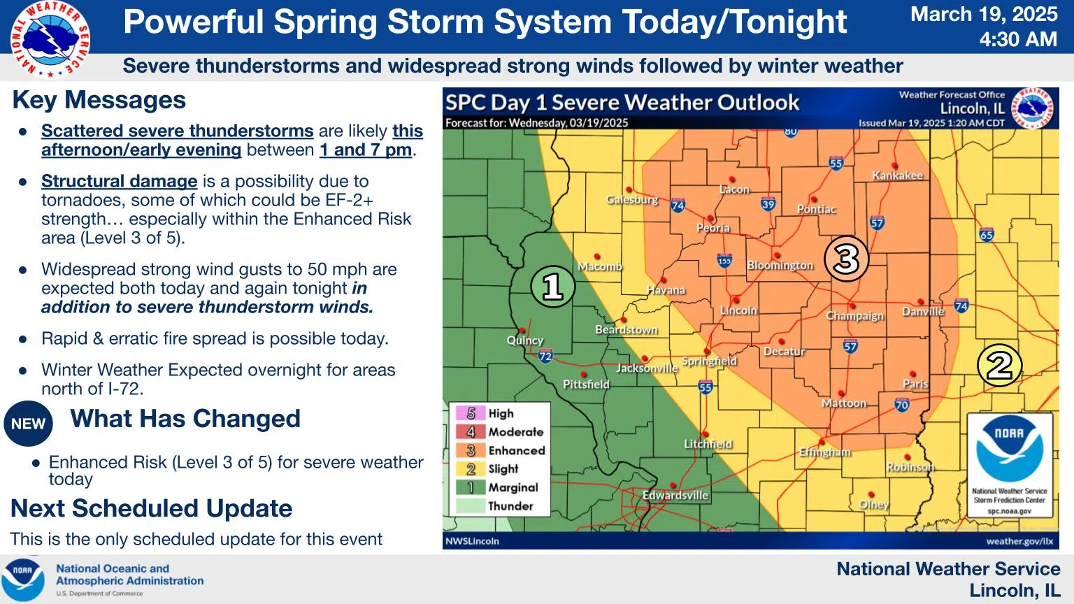
An enhanced risk (level 3 of 5) of severe weather is in place for this afternoon for parts of central/eastern IL. We are expecting damaging winds, large hail, and an isolated tornado or two.
Overnight, snow will move into central IL bringing minor accumulations. Although much of the snow will melt on roadways, slick spots are possible where higher amounts are seen, and reduced visibility will take place in snow.
A strong low pressure system will bring strong winds to the area this morning through Thursday morning. The first round of strong winds, gusting as high as 55 mph, will blow from the south-southwest late morning-afternoon, then shifting out of the northwest overnight.
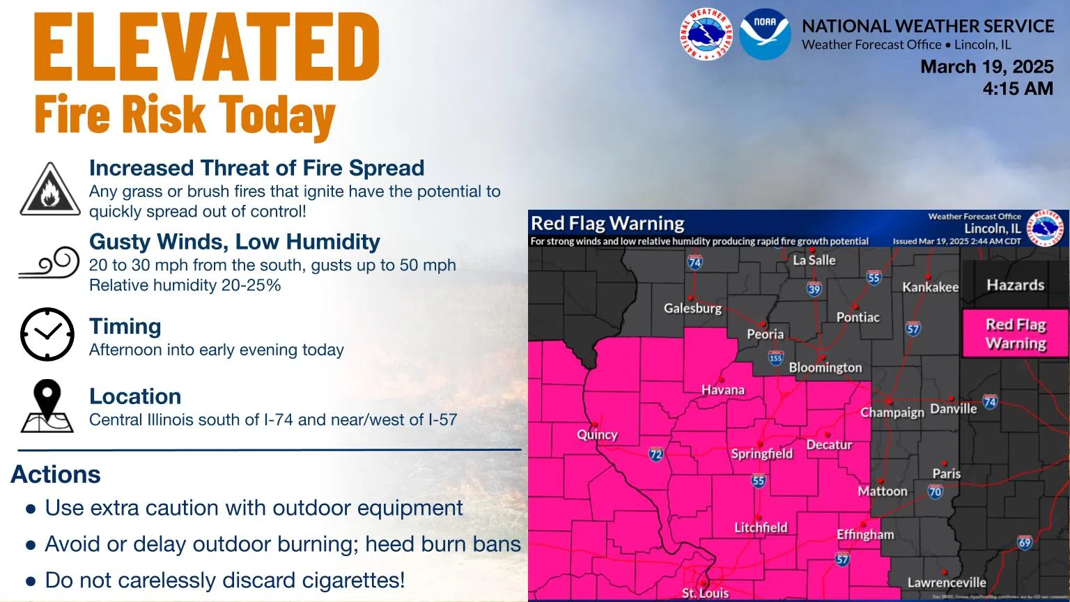
A red flag warning is in effect from 11 AM to 7 PM today for portions of central IL south of I-74 and from I-57 westward today due to strong winds and low relative humidity. Any grass or brush fires that ignite have the potential to quickly spread out of control. Use extra caution with outdoor equipment, avoid or delay outdoor burning, heed burn bans, and discard cigarettes properly.


Comments