
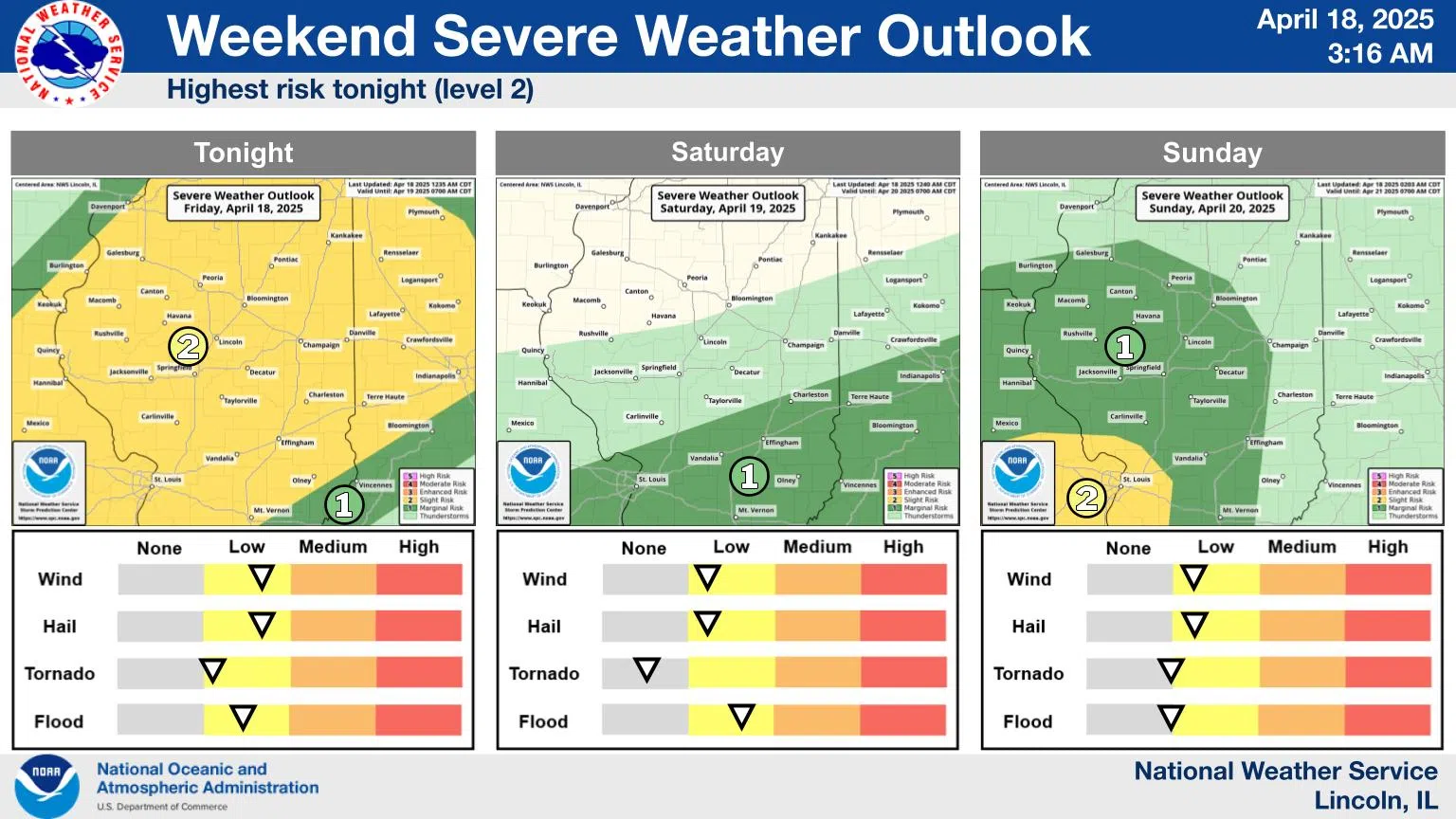
Effingham, IL-(Effingham Radio)- We once again have the chance for severe weather tonight, and flooding is possible through the weekend as waves of rain move through the area.
While there will be periods of strong to locally severe storms through the weekend, it currently appears that the best chances will be tonight. Damaging wind and some large hail are the main hazards, and while the tornado threat is very low, it is not zero.
The risk of heavy rain will increase as we get further into the weekend.
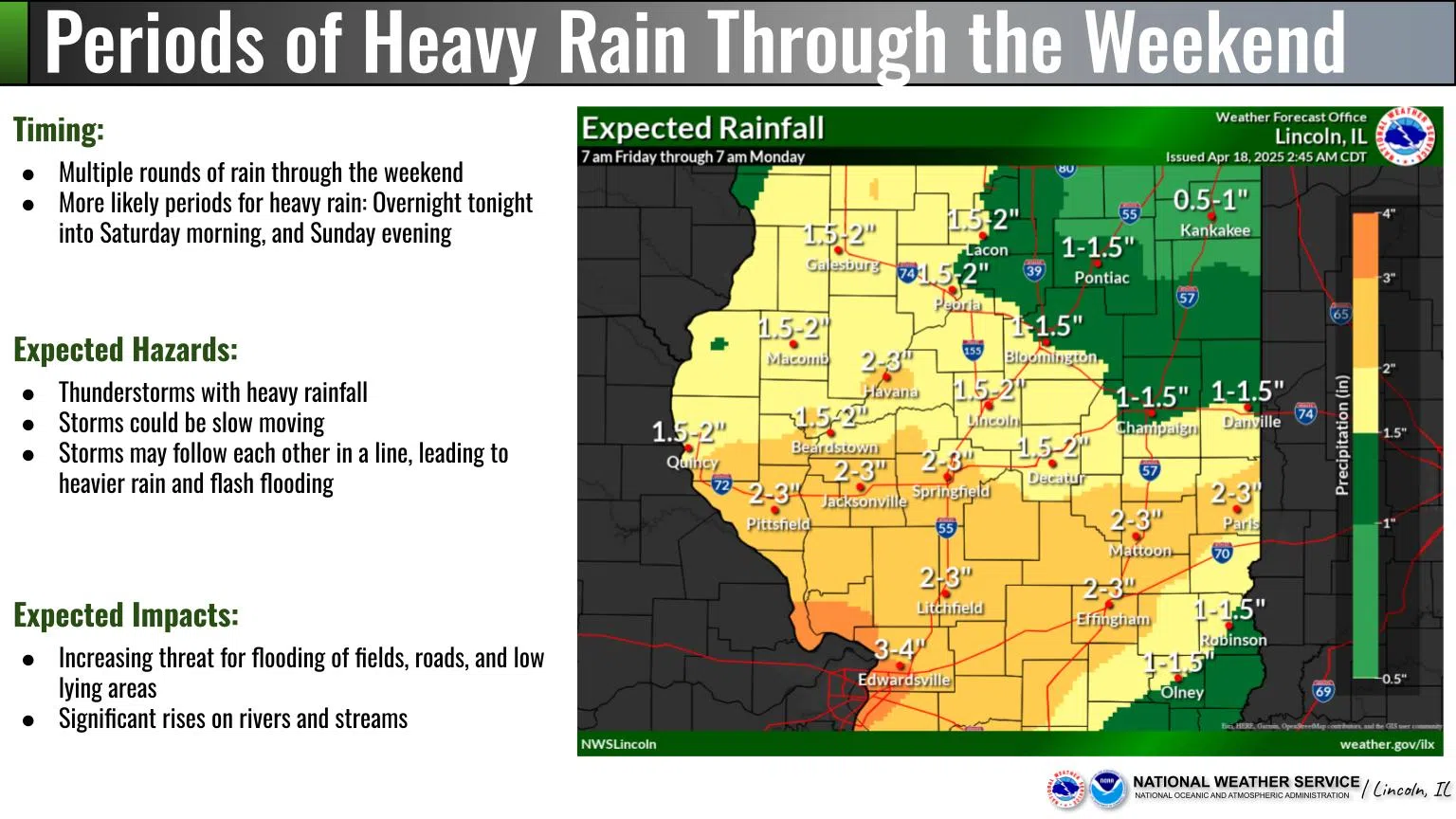
A cold front will stall near the I-70 corridor on Saturday, with the heaviest rain becoming more focused in that area. If the storms start “training” (following each other, like the cars on a train), that would increase the threat of flash flooding.
There is a flood watch for most counties from Fayette County to the southwest of the state that will remain in effect until 7pm Sunday.
Photos and Story Courtesy of NOAA


Comments