
 Effingham, IL-(Effingham Radio)- We have a good chance for enough rainfall that it could lead to some flooding in the local area.
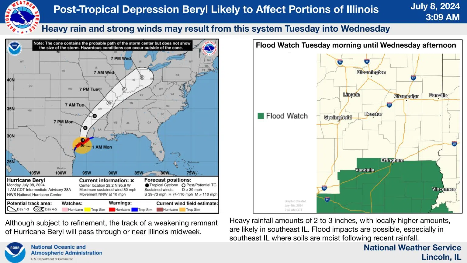
There will be chances for occasional showers and thunderstorms tonight. Tuesday through Wednesday morning, post-tropical depression Beryl will affect portions of central and southeast Illinois, with heavy rain and windy conditions possible especially for southeast and east-central IL. Heavy rainfall of a widespread 2-3 inches with locally higher amounts, as well as areas of over 30 mph sustained winds, are possible. A flood watch is in effect Tuesday morning until Wednesday afternoon near and south of I-70 where the heaviest expected rains combine with moist soils from recent heavy rain. Keep an eye on the forecast as the track and impacts of this system are refined over the upcoming day or two.
Temperatures will be slightly above normal today with mid to upper 80s forecast, although slightly below normal temperatures will be common the next few days, with highs from around 80 to the mid 80s.
Photo and Story Courtesy of NOAA


Comments