
 Effingham, IL-(Effingham Radio)- Severe storms are slated to move through the area tonight, and it brings a significant chance for large hail and tornadoes.
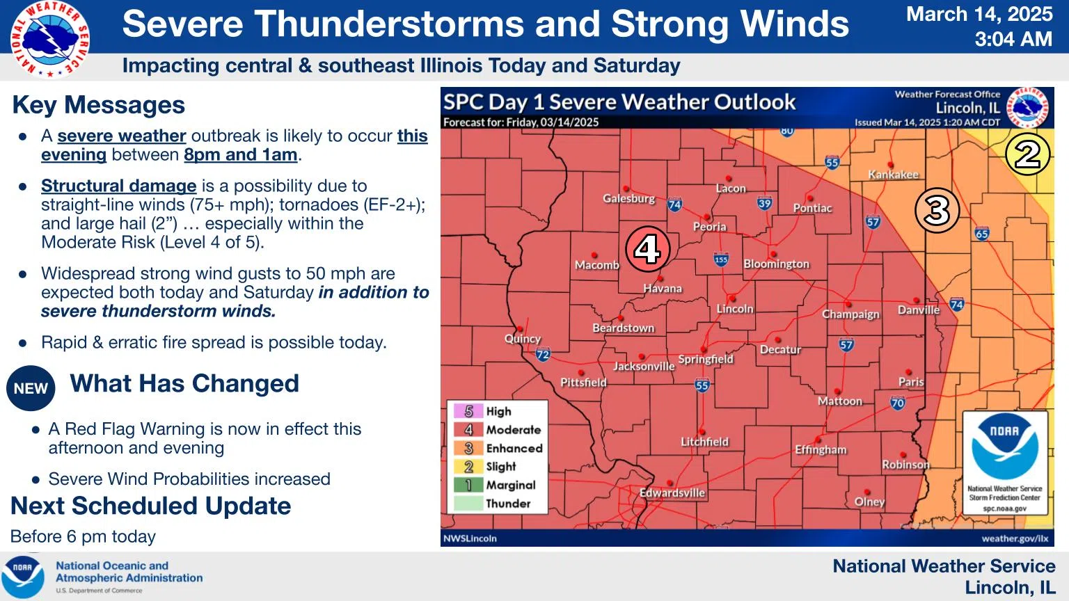
A strong storm system will produce severe thunderstorms in central IL this evening. Potential hazards include 75+ mph straight-line winds, EF-2+ tornadoes, and 2″+ diameter hail.
Additional thunderstorms are possible Saturday east of I-57, although the severe weather threat will be mainly southeast of the area. Light rain and snow are possible Saturday night. Very warm conditions today will bring highs to around 80 degrees.
A Wind Advisory is in effect through Saturday afternoon for widespread wind gusts to 50 mph. In addition to tree damage and a few power outages, these winds could produce localized low visibility in blowing dust. Avoid areas of dense dust if possible. If you encounter dense dust, slow down, pull off the roadway as far as possible, and set the parking brake. Turn off lights and take your foot off the brake pedal to prevent moving traffic from following your tail lights.
Conditions will cool off over the weekend, for highs mainly in the 60s Saturday and upper 40s Sunday. A warming trend will resume early next week.
Photo & Story Courtesy of NOAA


Comments